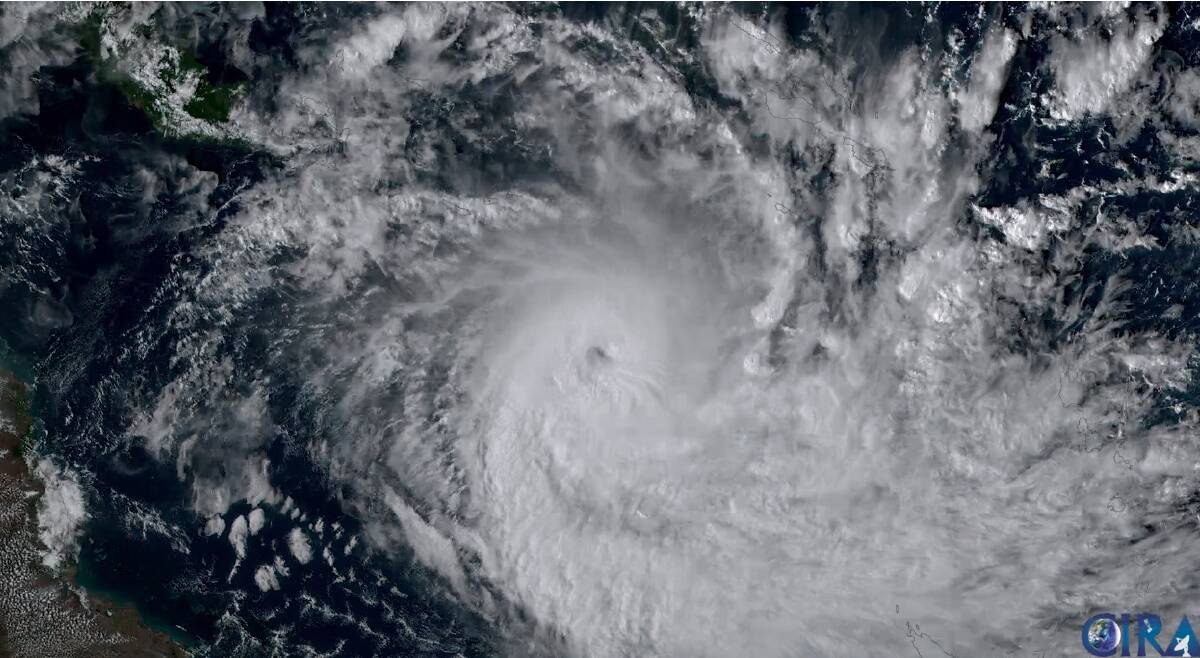
Communities in Far North Queensland have been warned to prepare for destructive winds and flash flooding as Tropical Cyclone Jasper approaches the coast.
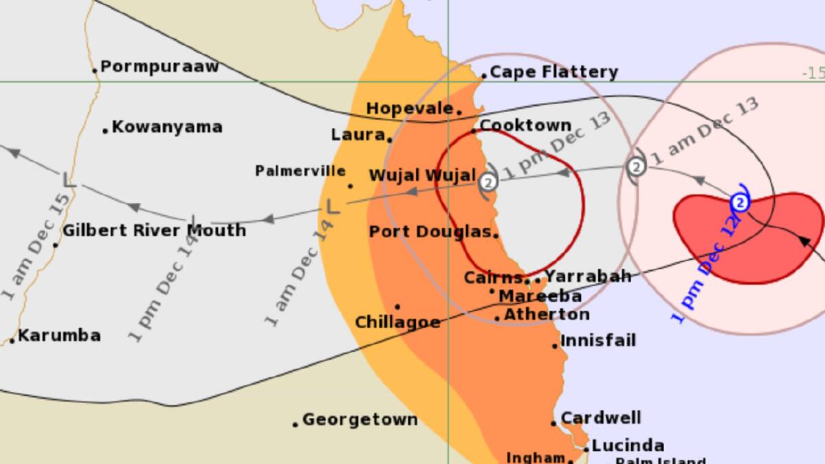
Jasper has re-intensified to a category 2 system and is about 235km east north-east of Cairns as of 1pm AEST on December 12, according to the Bureau of Meteorology.
The cyclone may intensify slightly more before its forecast landfall between Cooktown and Cairns on December 13.
People in the area between Cape Flattery and Lucinda, and inland to Chillagoe, are being warned to immediately commence or continue preparations, such as securing boats and property.
Communities in the warning area are warned of gales with damaging winds up to 120kmh developing on December 12.
Destructive wind gusts of up to 140kmh may develop early on December 13 between Wujal Wujal and Innisfail.
Heavy rainfall could cause life-threatening flash flooding between Cape Flattery and Port Douglas, with isolated six-hourly rain totals of 250 to 300mm likely.
Twenty-four hour rainfall totals between 400 and 500mm are possible.
A flood watch is in place for the the North Tropical Coast, parts of the Cape York Peninsula and Gulf Country.
And a storm tide delivering large waves may cause minor flooding along the foreshore.
Jasper developed to a severe category 4 system before weakening to category 1 during the weekend.
The cyclone will weaken as it moves inland on December 14 across the Cape York Peninsula, but could re-intensify over the Gulf of Carpentaria later in the week, according to the Bureau.

On December 9, four Bureau of Meteorology staff stationed off the coast on the remote Willis Island weather station were evacuated out of the path of the cyclone by the Australian Navy.
First tropical cyclone of the 2023-24 season
Jasper is the first tropical cyclone of the season in Australia's Area of Responsibility, and the first to cross the Queensland coast in several years.
In Australia the tropical cyclone season is from November 1 to April 30.
The most cyclone-prone area is the WA coast between Broome and Exmouth, but northern Queensland and the Northern Territory are also often impacted.
There were six tropical cyclones during the 2022-23 season.
The last for the season was Severe Tropical Cyclone Ilsa which crossed over the Western Australian coast at Pardoo, 150km north of Port Hedland as a category five system in April.
The Bureau will issue warnings every three hours with the latest information as Jasper approaches the Queensland coast.
Keep updated with cyclone warnings at bom.gov.au/qld/warnings
- For cyclone preparedness and safety advice visit Queensland's disaster management services website disaster.qld.gov.au
- For emergency assistance call the Queensland State Emergency Service on 132 500, for assistance with storm damage, rising flood water, fallen trees on buildings or roof damage.


